
 Drone Services
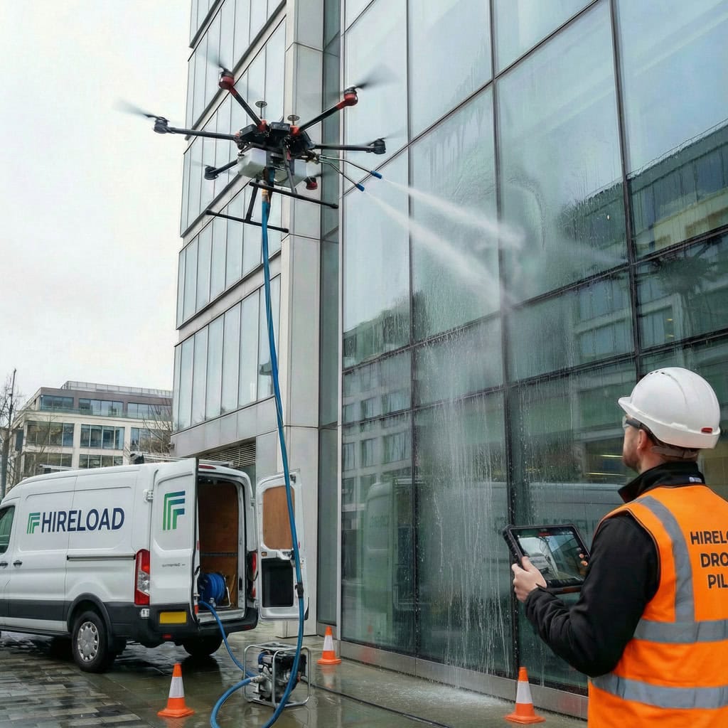
 Access Equipment
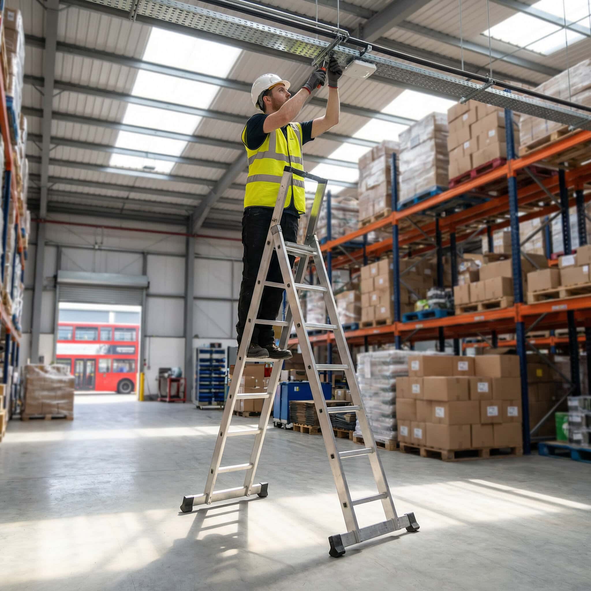
 Breaking & Drilling
 Cleaning Equipment
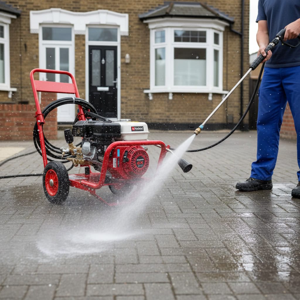
 Drying & Heating
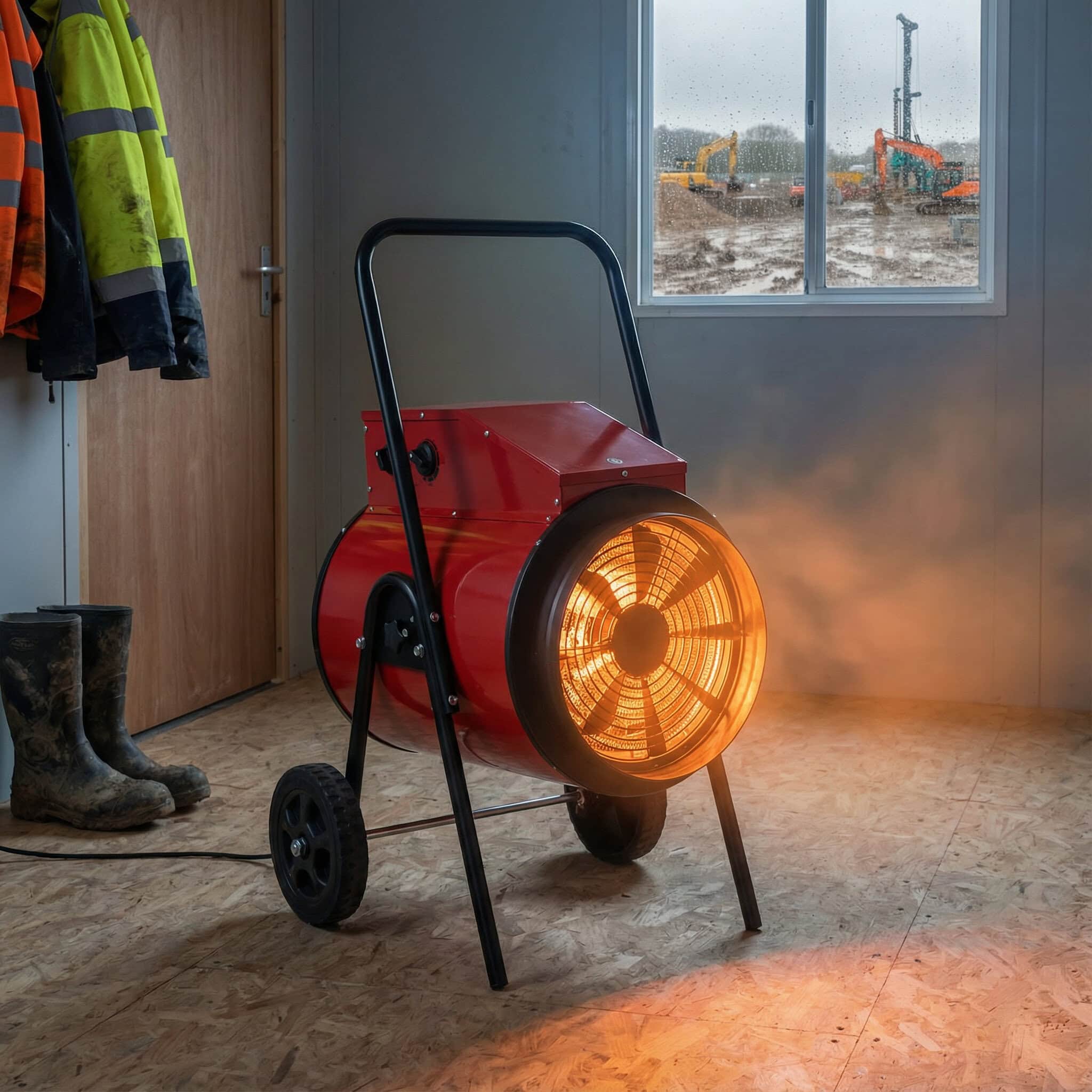
 General Site Tools


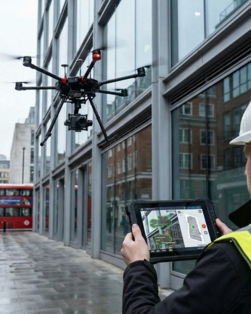
Drone Surveying & Mapping | Accurate Reliable Site Data & Deliverables


From £599.00 + VAT
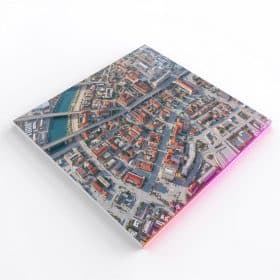
Drone Surveying & Mapping from £599 per site. High-resolution, georeferenced data with clear deliverables: orthomosaic maps, 3D models, point clouds and measurements where suitable. Book online, add postcode and scope, we confirm feasibility and airspace before attending.
- Construction and commercial sites progress and planning
- Clean outputs GeoTIFF, LAS, models and reports
- Minimal disruption no scaffolding, fast capture
Standard Delivery & CollectionDelivered to your door and collected when your hire ends. Both trips, one price.£35
Click & CollectSkip the delivery fee and collect from our West London depot. Usually ready the same day.FREE
Live tracking on every deliveryDeposit refunded in 2-3 working days020 3375 4048
Day based pricing : Surveying & Mapping – London
Friday
- £599.00
Saturday
- £599.00
Sunday
- £599.00
Monday
- £599.00
Tuesday
- £599.00
Wednesday
- £599.00
Thursday
- £599.00
Hourly based pricing
£89.00 / per hour
Latest estimated delivery date: Monday 6. July
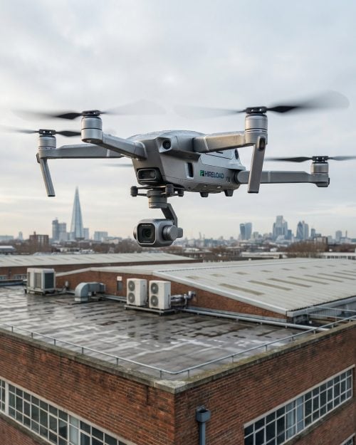
🚁 Drone Surveying & Mapping — London
🚁 Drone Surveying & Mapping London — aerial site insight for suitable projects
Drone surveying and mapping for suitable London construction, commercial, property and site review projects. It may help capture aerial context, visible site condition and project progress where access, visibility, weather and operational assessment make drone work suitable.
Outputs, method and suitability must be confirmed before booking. Drone outputs do not replace specialist legal, structural, engineering or chartered survey reports unless specifically agreed. London service by booking.
🚁 Drone surveying
🗺️ Aerial mapping
🏗️ Construction & property sites
🛡️ Site assessment required
📍 London service by booking
🗺️ Aerial mapping
🏗️ Construction & property sites
🛡️ Site assessment required
📍 London service by booking
✅ Quick answer
What is drone surveying and mapping used for?
Drone surveying and mapping is a visual aerial data-capture approach that may be suitable for selected construction, commercial, property, facilities and external site review projects. It can help capture aerial context, visible site condition, roof and building views, progress records and mapping-style visual information where the site, weather, visibility and agreed scope make it suitable. The exact method and outputs must be confirmed before booking.
Drone survey outputs do not replace specialist legal land surveys, structural engineering reports, measured building surveys or chartered survey reports unless specifically agreed with qualified professionals. Suitability depends on site, access, airspace, visibility, weather, surroundings and operational assessment.
Contractors, developers and commercial or facilities teams across London come to us for drone surveying London and drone mapping London — from a commercial drone survey London or construction drone survey London through to a drone site survey London or property drone survey London. The same service covers enquiries described as aerial surveying London, UAV surveying London, photogrammetry drone survey London, drone inspection and mapping London and 3D drone mapping London, where the requested output is suitable, feasible and agreed before booking. We also handle wider drone mapping services UK enquiries from our London base by booking. For a drone survey quote in London, share your project details and we’ll confirm feasibility and the right approach.
🧭 Choose by project
Different projects suit different outputs. Pick the closest match — scope, outputs and feasibility are always confirmed before booking. Whether it’s a commercial drone survey London or a wider drone mapping services London enquiry, we’ll help you scope it.
🏗️Construction site overviewAerial context for construction site mapping London and site review work where suitable.Confirm scope before booking →
📐Site progress recordsSite progress drone survey London visuals to document visible project stages over time.Confirm scope before booking →
🏢Commercial property reviewProperty drone survey London context for managed and commercial buildings where suitable.Confirm scope before booking →
🏠Roof / building exterior surveyRoof and building drone survey London views for visible exterior condition review.Confirm scope before booking →
🗺️Land / external area mappingDrone land survey London and aerial mapping London context where access allows.Confirm scope before booking →
🔎Unsure what output you needTell us the project and we’ll help confirm whether drone surveying or mapping suits.Call / email to discuss →
🎯 Best for & check first
Drone surveying and mapping suits some projects well and is not right for others. Here’s where an aerial surveying London or UAV mapping London approach may help — and where to check first.
✅ Best for
- Suitable construction and site overview enquiries
- Commercial property and facilities teams
- Site progress documentation where suitable
- Aerial roof and building visual review
- Land and external area context where suitable
- Property maintenance drone survey London planning
- Stakeholders needing visual site information where agreed
⚠️ Check first
- Restricted airspace or sensitive locations
- Busy public areas and crowded sites
- Poor weather, rain or high wind
- Poor visibility
- Indoor or covered areas
- Sites requiring a legal boundary survey
- Sites requiring structural engineering assessment
- Sites requiring guaranteed measurement accuracy
- Projects requiring CAD/BIM/GIS outputs unless verified and agreed
📋 Is drone surveying or mapping suitable for your site?
Every site is reviewed before scope and outputs are confirmed. These are the main factors we look at for a drone site survey London or aerial mapping services London project — share what you can and we’ll help assess suitability.
| Site / project factor | Why it matters | What we need to confirm |
|---|---|---|
| Project type | Different projects suit different aerial approaches. | Construction, commercial, property, facilities or land/site review. |
| Required output | The output you need shapes feasibility and scope. | Aerial views, mapping-style visuals or progress records. |
| Site location | Location affects access and operating conditions. | General area, site type and surroundings. |
| Airspace / surrounding area | Airspace and surroundings affect whether flight is feasible. | Nearby restrictions, sensitive sites and the local setting. |
| Visibility and weather | Conditions can pause or prevent operations. | Typical conditions and any timing constraints. |
| Public / pedestrian areas | People nearby must be considered and protected. | Footfall, entrances and neighbouring use. |
| Nearby obstacles | Obstacles affect safe operation and planning. | Structures, lines and surrounding features. |
| Site access and operating area | A safe operating zone is needed on site. | Space for safe take-off, landing and an exclusion area. |
| Accuracy / measurement requirement | Measurement needs must be discussed in advance. | Whether any measurement is required and at what level. |
| Deadline / preferred dates | Timing affects coordination and planning. | Available windows and any site restrictions. |
Suitability depends on the confirmed project type, site, access, airspace, visibility, weather, surroundings and operational assessment. Drone operations are subject to site assessment, weather conditions, safety checks and applicable operating requirements.
🔎 Drone surveying vs traditional survey methods
A quick, educational comparison. Each method has a different role and the right choice depends on the project, site and outputs you need.
| Method | May be useful for | Check first |
|---|---|---|
| Drone surveying / mapping | Aerial context, visible site condition, progress records and mapping-style visuals where suitable. | Airspace, visibility, weather, access and agreed scope — not all sites are suitable. |
| Traditional land survey | Legal, boundary and topographical land data from qualified surveyors. | Drone outputs do not replace a legal or topographical land survey unless agreed. |
| Building / structural inspection | Structural condition and engineering assessment by qualified professionals. | Drone outputs do not replace a structural engineering assessment. |
| Manual site photography | Close, ground-level documentation of accessible areas. | Access, height limitations and the area that can be safely reached. |
| Specialist measured survey | Measured building surveys and precise measurement deliverables. | Measurement requirements must be agreed in advance with qualified professionals. |
Drone surveying may provide useful aerial visual context where suitable, but it does not automatically replace legal, structural, engineering, CAD/BIM/GIS or chartered survey deliverables. The right approach is confirmed after a site review.
✨ How the service process works
1Send project details
Project type, location, the output you need and access notes.
2Initial scope review
We review the details and what you’d like the drone survey to cover.
3Site / safety assessment
Access, surroundings, airspace and safety are assessed.
4Output confirmation
Scope and outputs are confirmed only if the site is suitable.
5Drone visit by booking
Work is carried out with an agreed exclusion zone where suitable.
6Images / agreed outputs shared
Agreed visual outputs are shared after the visit, subject to scope.
Timings depend on site, weather, access, airspace and operational assessment. Drone operations are subject to site assessment, weather conditions, safety checks and applicable operating requirements.
📋 What to confirm before booking
Share these details for a drone survey quote London and we’ll help assess feasibility and prepare a quote.
🏗️Project type
Construction, commercial, property or land.
📍Site address / area
Postcode area and general location.
📐Required output
What you need from the survey.
🗺️Approx site area
Rough size if known.
🚪Access around site
Operating space on site.
⚠️Public / pedestrian areas
Footfall and neighbours.
🏢Nearby obstacles
Structures and surroundings.
🔎Visibility requirements
What needs to be seen.
🌝Preferred dates
Your ideal timing.
📞Site contact
Who to coordinate with.
📋Restrictions / permits
Access, hours or airspace.
🖼️Photos or plans
If available, they help.
⚠️ Safety & scope checklist
- Service is subject to a site review before any scope is confirmed.
- Not all sites are suitable for drone surveying or mapping.
- Weather and wind conditions affect whether work can proceed.
- Public areas and neighbouring properties must be considered.
- Nearby roads, rail, power lines and sensitive areas may affect suitability.
- Outputs must be confirmed before booking.
- Accuracy or measurement requirements must be discussed in advance.
- Drone outputs do not replace legal, engineering or specialist survey reports unless agreed.
- The method is confirmed only after assessment.
- Results and outputs depend on visibility, access, weather and agreed scope.
❓ Drone Surveying & Mapping London — FAQ
Do you offer drone surveying in London?
Yes. We offer drone surveying London and drone mapping London for suitable construction, commercial, property, facilities and land/site review projects, with a London service by booking. Every site is reviewed and feasibility confirmed before scope and outputs are agreed.
What is drone surveying and mapping?
Drone surveying and mapping is a visual aerial data-capture approach that uses a drone to capture aerial context, visible site condition, roof and building views and mapping-style visuals on suitable sites. The method and outputs are confirmed after a site review and are not suitable for every project.
What can a drone survey be used for?
A drone survey London may be used for construction site overviews, site progress records, commercial property and roof/building visual review, and land or external area context where suitable. The right approach and outputs depend on the project, site and agreed scope.
Is drone surveying suitable for construction sites?
It can suit construction site mapping London and progress documentation where access, airspace, visibility and surroundings allow. A construction drone survey London is always scoped and feasibility confirmed before attendance, and is not suitable for every site.
Can drones help with site progress records?
Yes. A site progress drone survey London can capture visible project stages over time for documentation and stakeholder updates, where suitable. Timing and outputs are agreed in advance and depend on site, weather and access.
Can you provide drone mapping?
We provide drone mapping services London and aerial mapping services London for suitable sites, capturing mapping-style aerial visuals where the project, access and conditions allow. Specific outputs are confirmed against feasibility and agreed scope before booking.
Does drone mapping replace a land survey?
No. Drone outputs do not replace a legal, boundary or topographical land survey unless specifically agreed with qualified professionals. A drone land survey London visit may provide useful aerial visual context alongside, not instead of, a formal land survey.
Can drone surveying replace a structural inspection?
No. Drone surveying does not replace a structural engineering assessment or specialist inspection. It may help capture visible exterior condition where suitable, but structural and engineering conclusions require qualified professionals.
What outputs can I request?
You can discuss outputs such as aerial imagery, mapping-style visuals and progress records, and where suitable other mapping outputs subject to feasibility and agreed scope. Available outputs are confirmed before booking — we don’t guarantee a specific output until feasibility is checked.
Do you need to inspect the site first?
Yes. A site review and safety assessment are required before scope and outputs are confirmed, covering project type, location, airspace, access, visibility, surroundings and operating conditions.
Does weather affect the service?
Yes. The service is subject to suitable conditions — wind, rain and poor visibility can pause or prevent operations. Timing is coordinated around weather and site conditions.
Can you work around public areas?
Public areas, footfall and neighbouring properties are always considered during the site and safety assessment. Some busy or sensitive locations may affect whether a drone survey London is suitable.
Do you provide CAD/BIM/GIS files?
CAD, BIM and GIS deliverables are not assumed or guaranteed. If you need specific technical file outputs, tell us in advance and we’ll confirm whether they’re feasible and agreed as part of the scope before booking.
What information do you need for a quote?
Helpful details include project type, site address or postcode area, required output, approximate site area, access details, nearby public areas and obstacles, visibility requirements, preferred dates and any photos or plans. This helps us assess feasibility for a drone survey quote London.
How do I book a drone survey?
Call or email with your project details and we’ll review scope, confirm feasibility and arrange a London drone survey service visit by booking. Share property type, location, required output, access notes and preferred dates to get started.
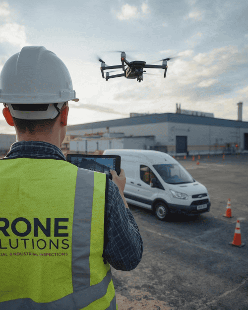
📞 Need drone surveying or mapping in London?
As a London drone survey service handling construction, commercial and property projects where suitable, we just need a few details to begin. Share your project type, site address / postcode area, required output, approximate site area, access details, surrounding risks or restrictions, photos/plans if available and preferred dates, and we’ll assess feasibility and prepare a quote.
| 4 Storey House | 1 |
|---|
Be the first to review “Drone Surveying & Mapping | Accurate Reliable Site Data & Deliverables”
Related products

Commercial Window Cleaning
Window Cleaning London | Professional Drone Window Cleaning (Commercial and Residential)
(1)
From £750.00 + VAT
Latest estimated delivery date: Monday 6. July
Commercial Roof Cleaning
Drone Roof Cleaning London | Safe & Efficient Commercial Roof Wash Without Scaffolding
(1)
From £750.00 + VAT
Latest estimated delivery date: Monday 6. July
From £595.00 + VAT
Latest estimated delivery date: Monday 6. July
 Drone Survey & Mapping
 Drone Inspections
Reviews
There are no reviews yet.